Comaps, a platform to Visualisieren Analysieren Simulieren
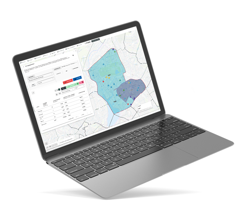

Comaps, a platform to Visualisieren Analysieren Simulieren
From planners
for planners
The core of comaps worked at the City Science Lab Hamburg for a long time, taking on and researching urban planning tasks on a daily basis. The software was developed by planning experts.
Functions
Companies from the private sector and municipal organizations select the features individually. We are happy to assist with the selection.

Future prognoses
Forecasts reduce financial risks and increase promising decisions
„Nachdem ich den Bedarf analysiert habe, schaue ich mir an wie die wahrscheinlichste Bevölkerungs-prognose für 2040 ist. Durch die Zeitreihen und Trenddarstellungen kann ich frühzeitig erkennen, wo planerische Entscheidungen nötig werden.“
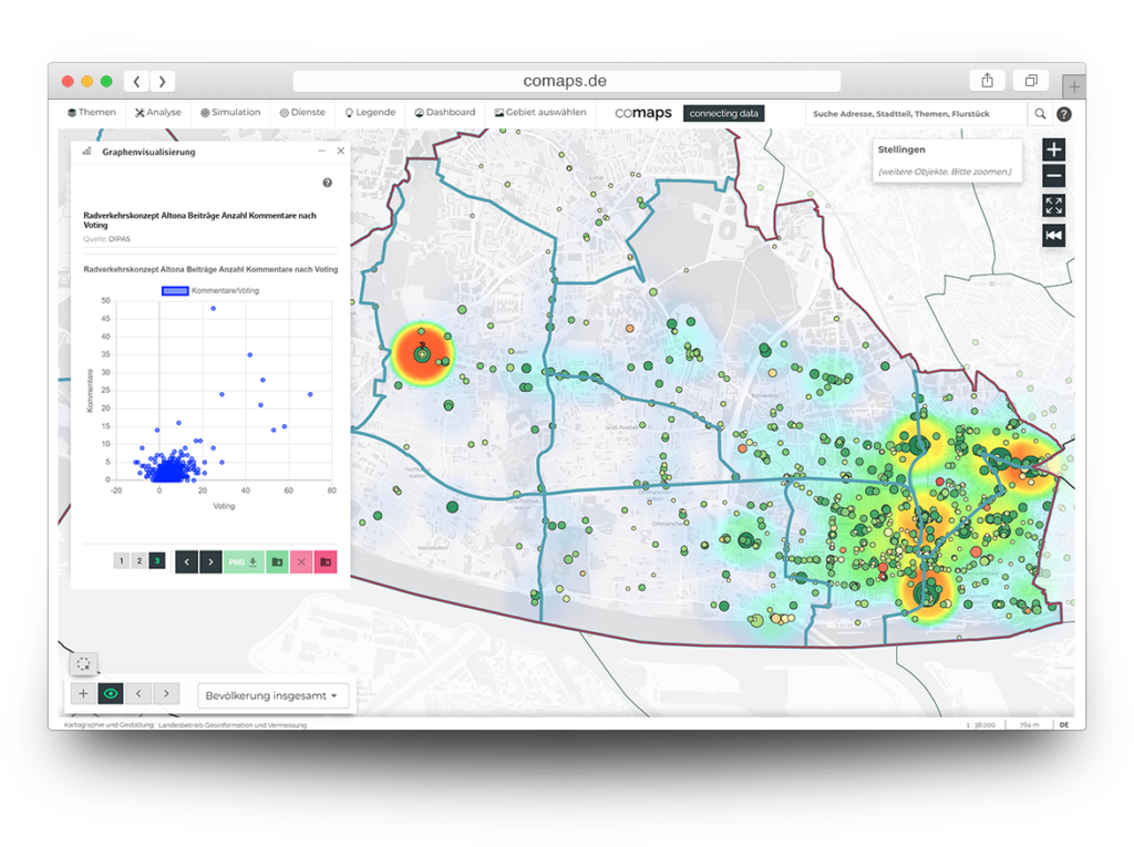

Data use
Users either link their own data or use open-source data
"My competitors must not be able to see my data under any circumstances. Through the view of open-source comaps data and my own, accessible only to me, I can recognize highly interesting connections for the first time."
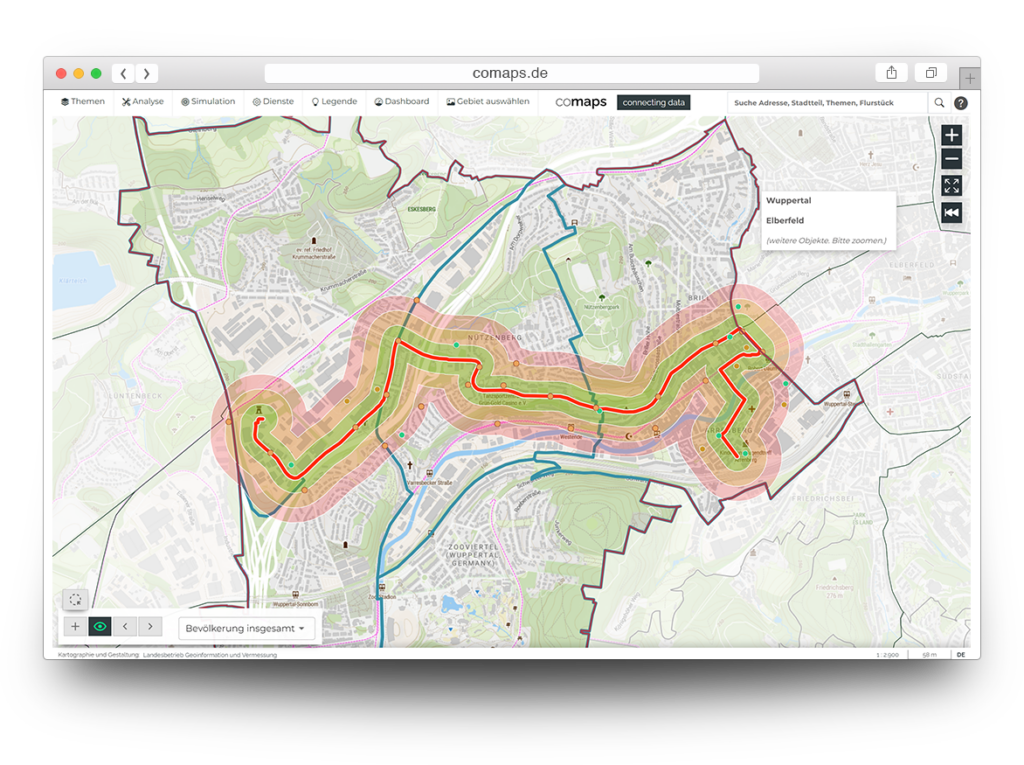

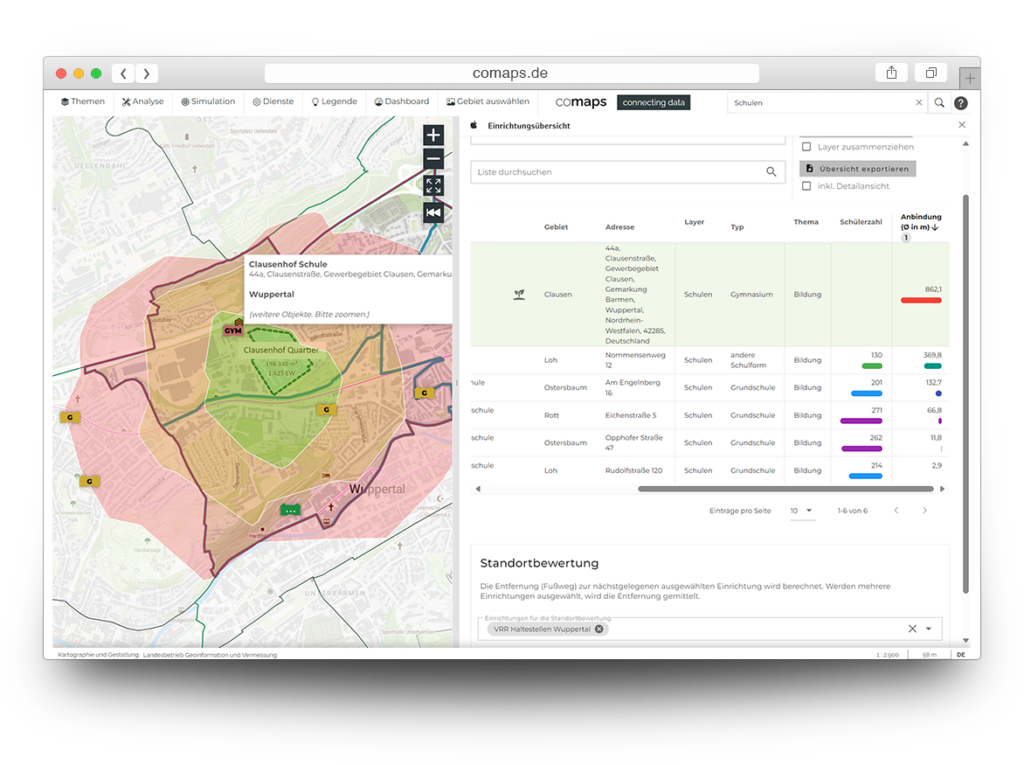
Accessibility analyses
Any locations can be checked for accessibility and gaps identified
"Within just two clicks, I can see everything that can be reached within 10 minutes by bike from point X. But I can also see, for example, which residential areas do not have a daycare centre within a 15-minute walk."
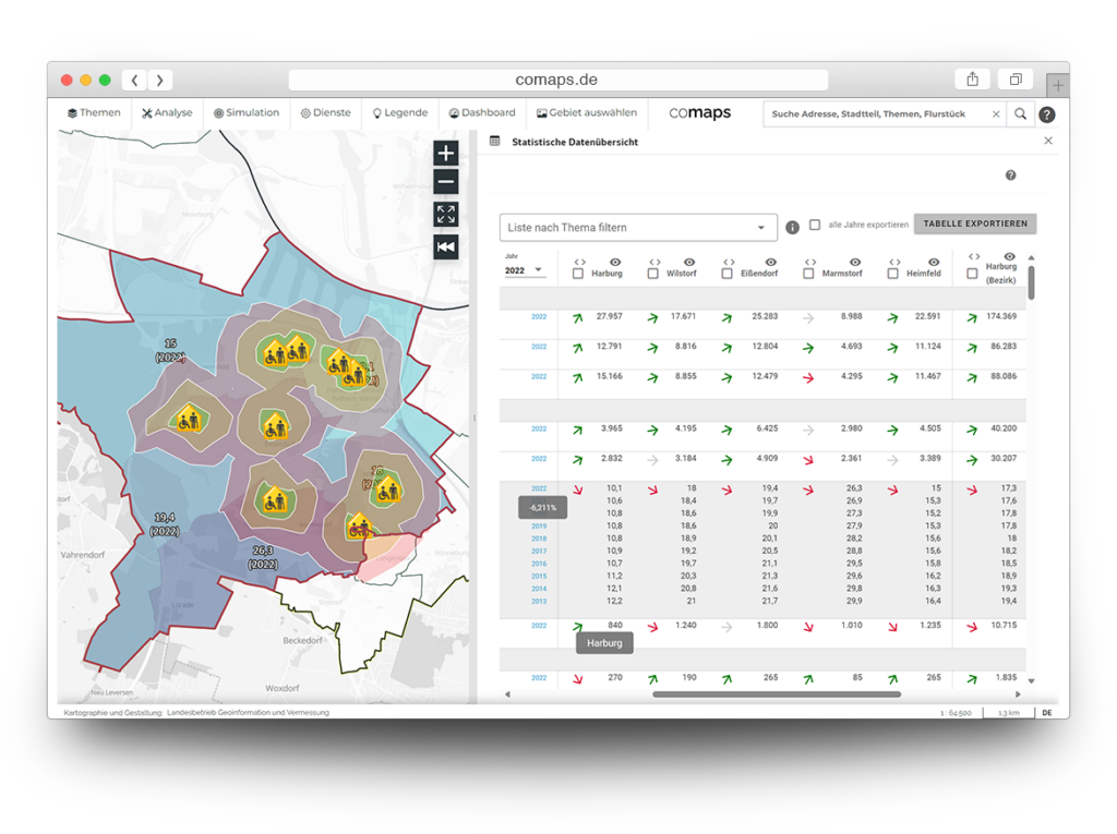

Demand response
Creation of needs analyses for daycare centres, offices, green spaces, public transport and much more
"Supply and demand suddenly become quite easy to identify. I can analyze various datasets simultaneously. Right now, I'm looking at how much office space is available in neighborhoods with residents aged 30 to 60."


Future prognoses
Prognosen verringern finan-zielle Risiken und erhöhen erfolgversprechende Entschei-dungen
"After analyzing the demand, I look at the most likely population forecast for 2040. Through time series and trend projections, I can identify early on where planning decisions will be necessary."


Data use
Users either link their own data or use open-source data
"My competitors must not be able to see my data under any circumstances. Through the view of open-source comaps data and my own, accessible only to me, I can recognize highly interesting connections for the first time."


Erreichbarkeits-analysen
Any locations can be checked for accessibility and gaps identified
"Within just two clicks, I can see everything that can be reached within 10 minutes by bike from point X. But I can also see, for example, which residential areas do not have a daycare centre within a 15-minute walk."


Demand response
Creation of needs analyses for daycare centres, offices, green spaces, public transport and much more
„Angebot und Nachfrage sind auf einmal ziemlich leicht zu erkennen. Ich kann verschie-dene Datensätze gleichzeitig analysieren. Ich schaue mir gerade an, wie viele Büro-Flächen es in Vierteln mit 30-60 Jahre alten Bewohnenden gibt.“
Our services
Alongside our flexible SaaS packages, we support you with the implementation of our WebGIS unserer WebGISapplication and ongoing operations. We customize modules or develop new ones to meet your requirements. Rely on our expertise to optimize your processes.

Software as a Service
Comaps enables a wide range of planning analyses: accessibility, demand, and public transport analyses, socio-demographic forecasts, and much more. Create scenarios and publish your results for others. Curated open-source data is available as a foundation for everything, with the option to expand with your own data.
Comaps provides hosting, operation, and maintenance—continuously updated and platform-independent—as well as training and support.

Connecting
In principle, our clients can link their data themselves. For larger planning projects with complex datasets that may not be in standardized GIS formats, we are happy to assist. In such cases, our team conducts meetings or workshops to identify and integrate data sources.

Tech-consulting
If you need additional urban planning consulting, don’t hesitate to reach out to us. Due to our academic background and origins, expertise is in our DNA.
Software as a Service

Comaps ermöglicht eine Vielzahl an planerischen Analysen: Bedarfs-, Erreichbarkeits-, ÖPNV-Analysen, sozio-demografische Prognosen und vieles mehr. Legen Sie Szenarien an und veröffentlichen Sie ihre Ergebnisse für andere. Als Grundlage für alles stehen kuratierte Open Source Daten zur Verfügung, die potentiell mit eigenen Daten erweitert werden können.
Comaps provides hosting, operation, and maintenance—continuously updated and platform-independent—as well as training and support.

Connecting
Grundsätzlich können unsere Kund:innen ihre Daten selbst anbinden. Bei einem größeren Planungsprojekt mit komplexen Datensätze, die womöglich nicht in den standardi-sierten GIS-Formaten vorliegen, unterstützen wir gerne. Unser Team führt in diesen Fällen Gespräche oder Workshops durch, um Datenquellen zu identifizieren und anschließend zu integrieren.

Tech-consulting
If you need additional urban planning consulting, don’t hesitate to reach out to us. Due to our academic background and origins, expertise is in our DNA.
Featured




Comaps in use


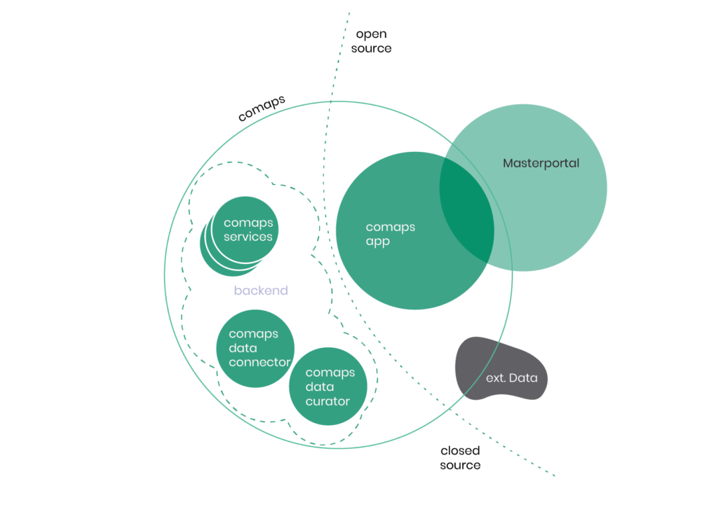
Open-Source Foundations
We are deeply committed to open-source. As part of the whole, the mapping application of our software is based on the City of Hamburg's Masterportal Open Source Framework. In 2018, our team further developed this mapping application in an academic context for the City of Hamburg, making it suitable for daily use. After the university project ended, it is now maintained by the State Office for Geoinformatics and Surveying (LGV)
To enable the application to be used by other cities and private companies, comaps was founded in 2022. Functions that have been added since then and are currently being developed are no longer in open-source repositories.
